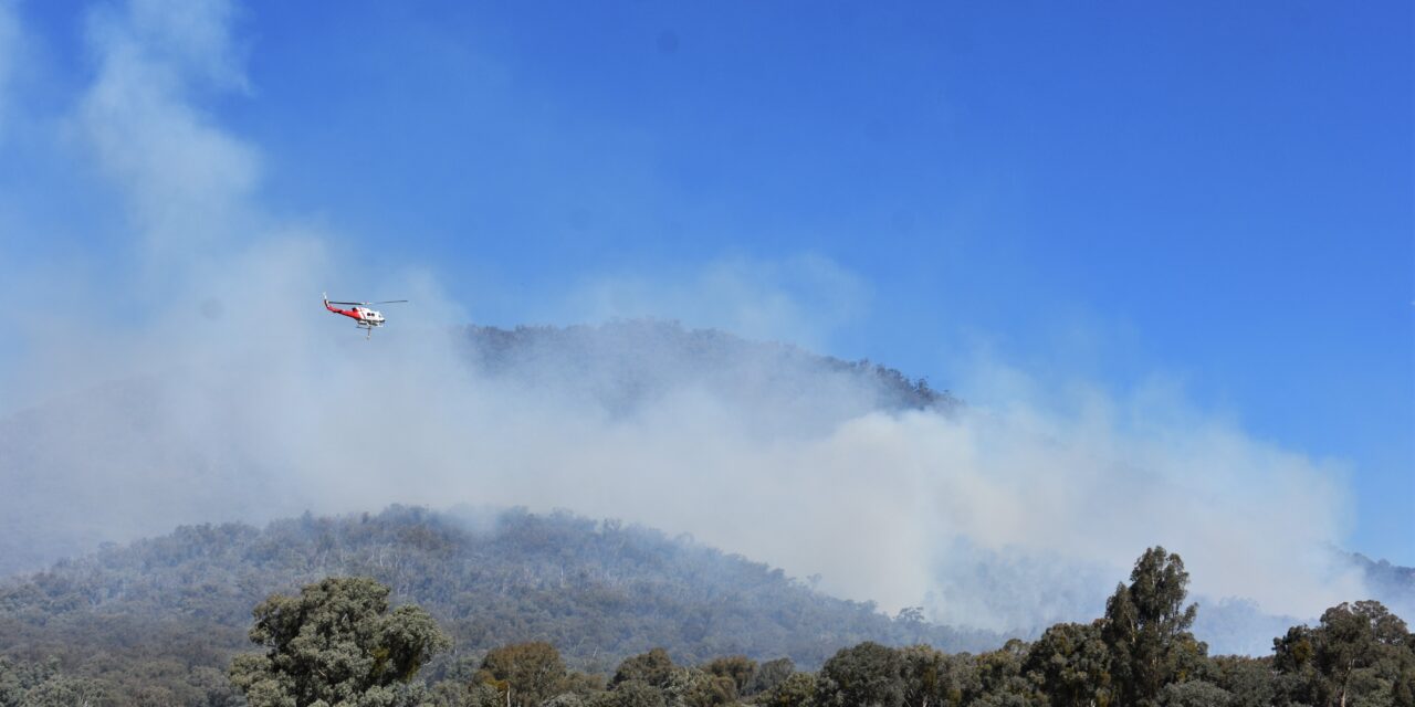
A new study has revealed when and where forest fuels are at their driest, offering fresh insights to improve bushfire risk assessment and prescribed burn planning across Australia.
In remote landscapes, fire managers often rely on natural features like gullies and creek lines to contain planned and unplanned burns, but success depends on knowing exactly how dry fuels are.
“Understanding not just if fuels are dry, but when they’re driest, can make the difference between a safe prescribed burn and an uncontrolled fire,” lead researcher Nick Wilson from the Bushfire Centre of Excellence Research Centre at the Australian National University said.
The NSW Smart Sensing Network Grand Challenge Fund project, led by researchers from ANU and Western Sydney University, set out to trial low-cost smoke and fuel moisture sensors to efficiently monitor the moisture content of bushfire fuel in real time.
But when the devices failed to provide reliable data, the team pivoted to a more fundamental issue: how well existing satellite and meteorological estimates of fuel moisture match real-world conditions.
By comparing high-quality in-situ sensors with satellite and meteorological products, they found that while remote data was generally accurate, it was less reliable in extreme terrain such as ridge tops, gullies and areas of dense vegetation, where moisture can vary sharply over short distances.
The researchers also found that forest fuels reach their driest point about two hours after the air is driest, with the hottest and driest air occurring about 3pm but fuels continuing to lose moisture until about 5pm — a lag not previously documented.
“Recognising the late-afternoon lag in fuel drying is crucial for safe prescribed burns and for anticipating how bushfires might behave as conditions change through the day,” Dr Wilson said.
“Our study also found that satellite data can be trusted for broad-scale monitoring of bushfire fuel moisture, while expensive ground-based sensors should be placed strategically in complex landscapes.”
The findings provide a stronger evidence base to guide prescribed burn planning for fire managers.
The project was a partnership with Western Sydney University, industry partner Indicium Dynamics and government partners Forestry Corporation of NSW and ACT Parks and Conservation Service.
“At Indicium Dynamics, our focus is turning cutting-edge research into tools that can be deployed at scale,” Indicium Dynamics chief executive officer Rob Vernon said.
“Through digital tools like our Fire Foresight platform, we are integrating satellite-derived data, ground-based sensing and live AI camera monitoring to deliver accurate, real-time situational awareness on prescribed burn monitoring and early bushfire detection.
“Partnering with ANU, Western Sydney University and fire agencies ensures that new insights, like this late afternoon drying effect, are translated into technology that keeps communities, asset owners and firefighters safer.”
Forestry Corporation of NSW land management and innovation manager James Carter said the techniques would be crucial to increasing efficiency in burning, as well as understanding environmental conditions in more detail when suppressing wildfire.
“With diminishing windows of opportunity to undertake important ecological and hazard reduction burns, using techniques such as this allows us to rapidly fine tune and make the most of those opportunities,” he said.
ACT Parks and Conservation Service prescribed burning and research utilisation manager Adam Leavesley said the service used some excellent tools for planning its landscape burns, but there was always a question come ignition day about whether conditions on the ground matched the climate models.
“This work brings us a big step closer to bridging that gap, so that we can be more confident of what a burn will do when we light it and we can deliver safer burns with better environmental outcomes,” he said.
NSSN Natural Hazards and Smart Places Theme lead Peter Runcie said the innovation network was pleased to have supported the important research.
“It advances our understanding of how to use in-situ and remote sensing together to gain a more accurate view of fire fuel moisture over large geographic areas,” Mr Runcie said.
“Collaboration between the research, industry and government partners is essential not only to this project, but to future development of decision support tools for use by land and fire managers.”
The project team is now developing tools which combine satellite data with topography and vegetation maps to produce finer-resolution fuel moisture estimates — improving accuracy from kilometre-scale down to as little as 30m.
In the long term, the researchers aim to refine how different components of forest fuel — from leaf litter and bark to grasses and canopy — are represented in fuel moisture models, which has implications for fire behaviour predictions.
Research uncovers bushfires’ critical hour


